GK-2A Test Week
Between Monday 2nd and Friday 5th of July 2019 the KMA NMSC conducted testing of their new geostationary weather satellite GEO-KOMPSAT-2A (GK-2A). This post is a summary of the testing carried out during this period, as well as some observations regarding new data types and formats.
RF Carriers
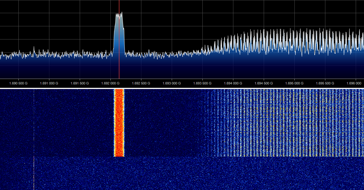
Around 9:50 AM KST the COMS-1 L-Band transponder was switched off to make way for the GK-2A LRIT and HRIT carriers. Initially only a strong Command and Data Acquisition Station (CDAS) carrier containing raw sensor data from GK-2A was visible.
GK-2A L-Band testing has begun! COMS-1 LRIT/HRIT carriers and their transponder are now off.
— Sam (@sam210723) July 1, 2019
GK-2A CDAS carrier is booming in. pic.twitter.com/q1DWbhZ8Fv
LRIT and HRIT carriers containing processed GK-2A data appeared later in the day. HRIT was running at the usual 3 Mbps (3 MSps QPSK), but the data rate of LRIT had increased to 256 kbps (512 kSps BPSK). This faster data rate is what COMS-1 LRIT used before it was reduced to 64 kbps (128 kSps BPSK) in late March.
We got our first look at GK-2A LRIT and HRIT carriers this afternoon. LRIT is back up to 512 kSps (256 kbps). https://t.co/Z3FbIHu9if pic.twitter.com/emZrPOhELl
— Sam (@sam210723) July 1, 2019
GK-2A LRIT and HRIT carriers were present for the rest of the week until around 11:00 AM on Friday 5th when the L-Band transponder was switched off. A few minutes later the COMS-1 L-Band transponder was re-enabled, followed by LRIT and HRIT carriers.
COMS-1 L-Band service is back after GK-2A testing completed just a few minutes ago.
— Sam (@sam210723) July 5, 2019
COMS-1 transponder could be seen starting up, followed by LRIT and HRIT carriers. pic.twitter.com/CTzPvZqybZ
Observations
Only minor protocol changes were seen during the testing period. Most notably, all sensor wavelengths were combined into a single virtual channel (VCID 0) rather than each wavelength having its own VCID.
| VCID | COMS-1 | GK-2A Testing |
|---|---|---|
| 0 | Visible | Full Disk (all channels) |
| 1 | Short-wave Infrared | not used |
| 2 | Water Vapour | not used |
| 3 | Infrared 1 | not used |
| 4 | Infrared 2 | Additional Data |
| 5 | Alpha-numeric Text | Alpha-numeric Text |
| 63 | Fill / Idle | Fill / Idle |
The observation interval of Full Disk images was drastically reduced from 3 hours to 10 minutes, allowing smooth animations to be created. No other image types such as COMS-1 Enhanced Northern Hemisphere were seen during the testing period.
All GK-2A test data was encrypted in the same way COMS-1 is, except using a different key. Thankfully this key was from the same key table used by COMS-1. See this blog post for a detailed look at the key table file and decryption process:
 sam210723
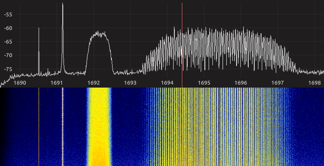
Normal COMS-1 operation has been restored and will continue to operate until GK-2A is officially brought online later this year.
First Full Disk image from GK-2A LRIT using COMS-1 keys for decryption!
— Sam (@sam210723) July 2, 2019
Images are being downlinked every 10 minutes, a huge improvement over the 3 hour interval of COMS-1. pic.twitter.com/plkWmKZd8s